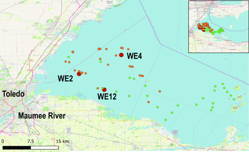
FIG 6.
Map of western Lake Erie HAB long-term monitoring stations, 2018 HABs Grab sample locations, and 2018 3G-ESP sample collection points. Western Lake Erie long-term monitoring stations are denoted with large red circles, 2018 HABs Grab samples are green circles, and 3G-ESP sample locations are orange circles. (The Open Street Map [OSM] [https://wiki.osmfoundation.org/wiki/Main_Page] was used as the basis for the map.)

