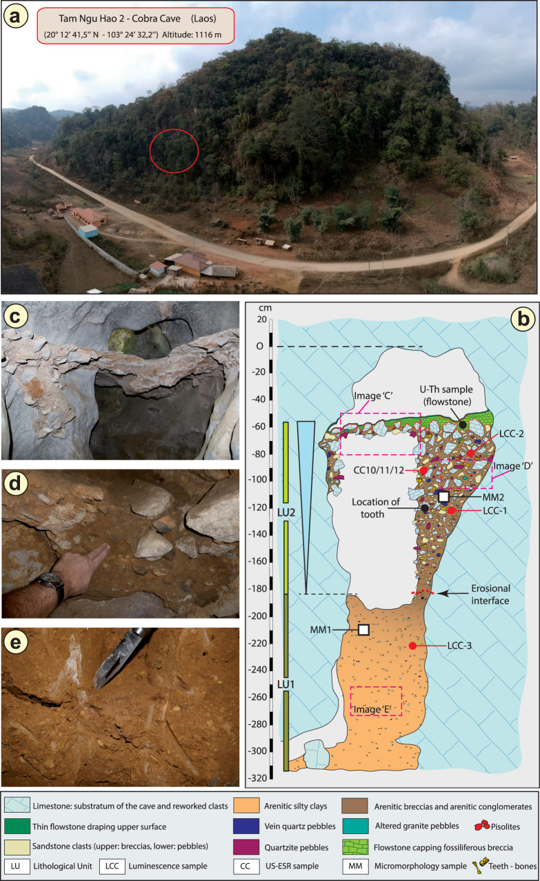
Fig. 1. Geomorphological context and stratigraphy of TNH2.
a Aerial view of the site. The red circle indicates the entrance of Tam Ngu Hao 2 cave. b Stratigraphy and sampling locations of the infilling of the cave, showing Lithological Unit 1 and 2 (LU1 and LU2) with the erosional interface between these layers indicated by a dashed red line; Micromorphological (microstratigraphic) samples (MM1 and MM2) are also shown. Encircled numbers denote approximate positions of photographs in c, d and e. c View of the flowstone capping the upper remaining part of LU2. d Detail of the arenitic breccia/conglomerate of LU2. e Detail of the arenitic silty clay of LU1.

