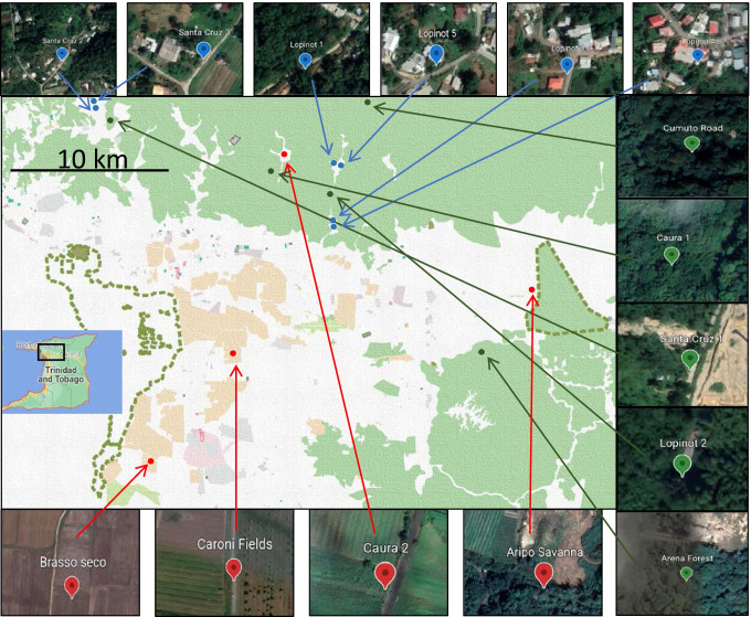
Fig. 1.
Map showing site locations and land use (white = buildings, brown = farming land, green = forested, pink/grey = large settlement). Green points = reference sites (2016: Cumuto road (R.CR), Caura 1 (R.C1), Arena Building (R.AB), Lopinot 2 (R.L2); 2018: Santa Cruz 1 (R.SC1)). Blue points = suburban sites (2016: Lopinot 3, 4 (U.L3, U.L4), Lopinot 1 (U.L1); 2018: U.L1, Lopinot 5 (U.L5), Santa Cruz 2, 3 (U.SC2, U.SC3)). Red points = agricultural sites (2016: Brasso Seco (A.BS), Aripo Savanna (A.AS), Caura 2 (A.C2); 2018: Caroni Fields (A.CF))

