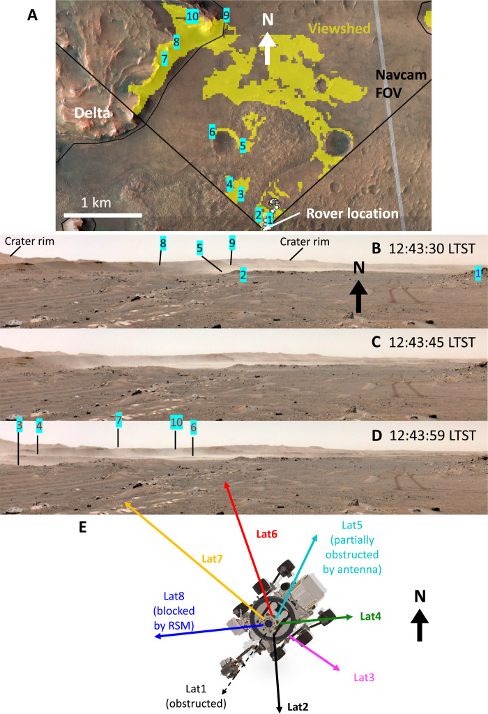
Fig. 3. The sol 117 gust lifting event in imaging.
(A) Features used to track the path of dust lifting/transport; yellow shading shows the “viewshed” (the surface that is line-of-sight visible) from the rover’s position. (B to D) The first, north-centered triplet of Navcam images, spaced ~14 s apart. Note that the right side of each image has been trimmed. (E) Azimuthal pointing of MEDA’s RDS photodiodes on this sol.

