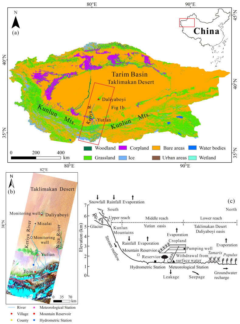
Fig 1.
(a) Location of the Tarim Basin in China, and land cover in 2018 in the Tarim Basin. Land-cover map is available for download through the Copernicus Climate Change Service (C3S) Climate Data Store (CDS), at a spatial resolution of 300-m. The China map was downloaded from http://bzdt.ch.mnr.gov.cn/, and the grant number is GS(2020)3183; (b) The Landsat 8 OLI images based on a composite of Band 7 (Red), 5 (Green) and 2 (Blue). Images show the location of the Keriya River Basin. The river channel north of Misalai is ephemeral; south of Misalai the channel is perennial. (c) Conceptual model describing the controls on the variations in surface runoff, including factors within the mountains, the agricultural oasis, and the desert in Keriya River Basin. Land-cover map and Landsat image were downloaded from the website https://land.copernicus.eu/global/products/lc [2018], and http://landsat.visibleearth.nasa.gov/, respectively. Because the map and image downloaded from these websites are free and open to scholars, our study does not need to supply a copyright notice.

