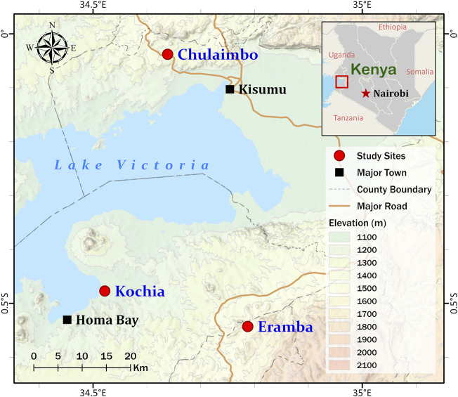
FIGURE 1.
Map showing Homa Bay (Kochia), Kisumu (Chulaimbo) and Kisii (Eramba) study sites in western Kenya. The sampling points are represented by the red circles on the map. This figure was prepared with ESRI ArcGIS Pro 2.8 with field survey results and publicly available datasets. The map contains information from OpenStreetMap and OpenStreetMap 115 Foundation, which is made available under the Open Database License.

