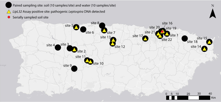
Fig 1. Map of Puerto Rico indicating sites where environmental samples were collected for the detection of pathogenic Leptospira spp. DNA from 2018–2020.
Black dots represent paired water and soil sites (n = 22); 20 samples were collected from each site (10 soil and 10 water). Yellow triangles indicate sites where pathogenic Leptospira DNA was detected (15/22 sites). One site in San Juan (site 16, red circle) was serially sampled three times over a 14-month period to assess persistence of pathogenic Leptospira in soil. This map was created using ArcGIS software by Esri. ArcGIS and ArcMap are the intellectual property of Esri and are used herein under license. Copyright Esri. All rights reserved. For more information about Esri software, please visit www.esri.com. Basemap: http://goto.arcgisonline.com/maps/Canvas/World_Light_Gray_Base.

