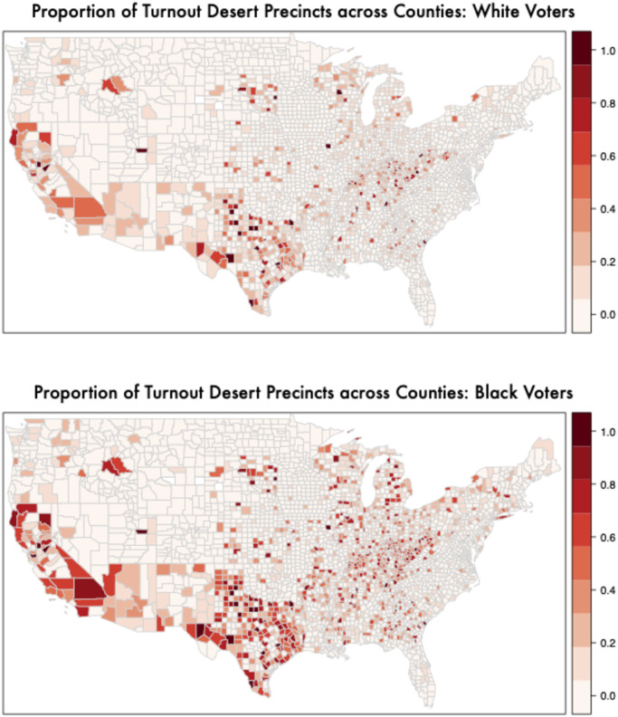
Fig 3. Mapping turnout deserts by racial groups (1) proportion of turnout desert precincts in a county by race (i.e. 1 standard deviation below the national average in voter turnout in 2016).
The top panel shows among precincts where White voters live; the second panel shows among precincts where Black voters live. Black (25.8%) individuals are more than 3 times more likely to live in a turnout desert precinct than white voters (8.3%). Minorities’ turnout deserts are spread across large/urban and small/rural locations. S13-S20 Figs in S1 File show similar maps for all groups in 2014 in addition to different definitions of turnout deserts.

