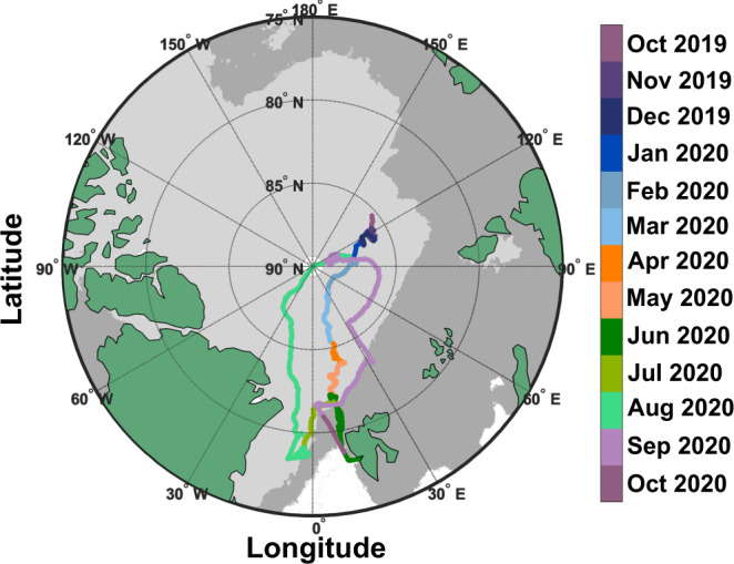
Fig. 1. Map of Polarstern location during the Multidisciplinary drifting Observatory for the Study of Arctic Climate (MOSAiC) expedition.

The ship track is colored by date. Only dates that involved ice nucleating particle (INP) sample collection are shown. Dark and light gray shaded areas represent the maximum and minimum sea ice extent (sea ice concentration ≥15%) in March and September 2020, respectively. Maps were created by the authors using MathWorks MATLAB (https://www.mathworks.com/products/matlab.html).
