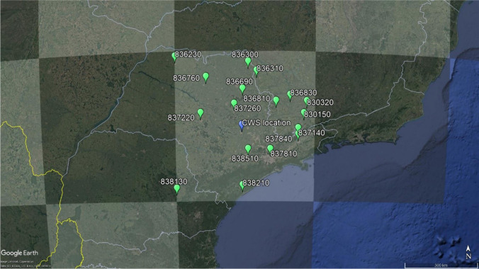
Fig. 3.
CRUTEM4 grid box (centroid in 22.5° South–47.5° West, Jones et al. 2012, https://crudata.uea.ac.uk) in light gray at center of the map and the 17 weather stations used to represent it in green markers: Maria da Fé (WMO code, 830,150), São Sebastião do Paraíso (836,310), Lambari (830,320), Poços de Caldas (836,810), Machado (836,830), Votuporanga (836,230), Franca (836,300), São Simão (836,690), Catanduva (836,760), Campos do Jordão (837,140), Bauru (837,220), São Carlos (837,260), São Paulo (837,810), Taubaté (837,840), Iguapé (838,210), Sorocaba (838,510), and Castro (838,130). ESALQ’s conventional weather station, located in Piracicaba, state of São Paulo, Brazil, is the blue marker in the map

