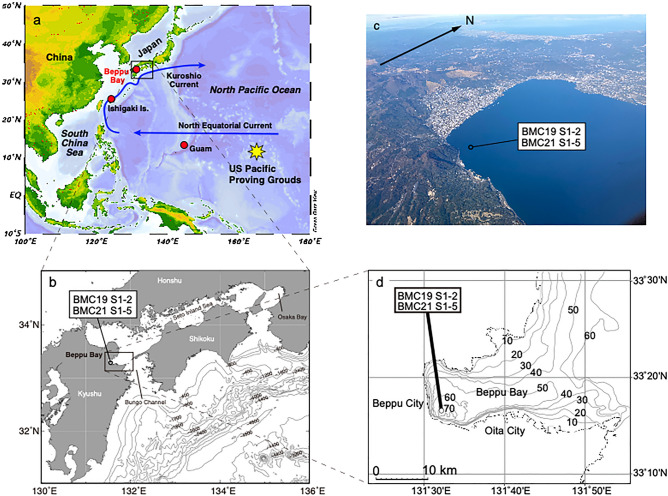
Figure 1.
Location of Beppu Bay and key locations in the North Pacific Ocean. (a) The US pacific proving ground (PPG) is located east of Guam, and the North Equatorial Current (NEC) and Kuroshio Current (KC). The software Ocean Data View Ocean Data View 5.4.0 (Schlitzer, R., Ocean Data View, http://www.awi-bremerhaven.de/GEO/ODV,2003.) was used to draw the map. (b) Beppu bay is located at the entrance of Setonaikai Inland Sea and is connected to the Pacific Ocean via the Bungo Channel. Map was generated using GMT with topographic data of ETOPO1 (https://www.ngdc.noaa.gov/mgg/global/global.html). (c) Aerial photo of Beppu Bay. The coring site for this study is also indicated. (d) Contours indicating the water depth in meters showing anoxic bottom water conditions are created by the depicted bathymetric feature. The map was drawn using the chart distributed by the Hydrographic and Oceanographic Department, Japan Coast Guard (https://www1.kaiho.mlit.go.jp/jhd-E.html).

