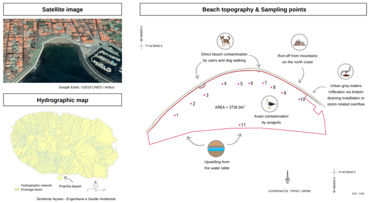
Figure 1.
Prainha beach—satellite image from Google Earth, ©2019 CNES/Airbus [48] and topography with an indication of the sampling sites 1 to 11 (supplied by the municipality). The hydrographic map of the island is also included to show the possible runoffs that could have an impact on the beach [49].

