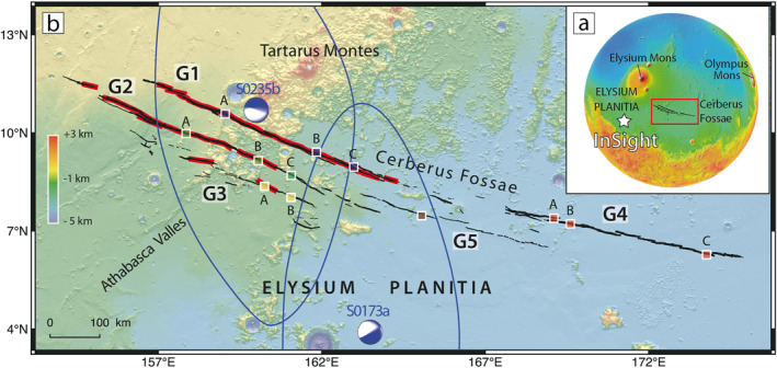
Figure 1.

(a) Topographic map of Mars (MOLA; Smith et al., 2001). The InSight landing site is indicated by the white star. The area of interest is included in the red rectangle. (b) Tectonic fault map focusing on Cerberus Fossae. Red lines are low‐resolution surface traces mapped by Knapmeyer et al. (2006). Black lines are surface traces from this study. Colored rectangles on each fossa point out HiRISE stereo pairs images used in this study (Figure 5). G1–G5 indicate the five major subparallel fossae (modified from Taylor et al., 2013). The blue ellipsoids and focal mechanisms of events S0173a and S0235b are modified from Giardini et al. (2020) and Brinkman et al. (2021), respectively.
