
Figure 5.
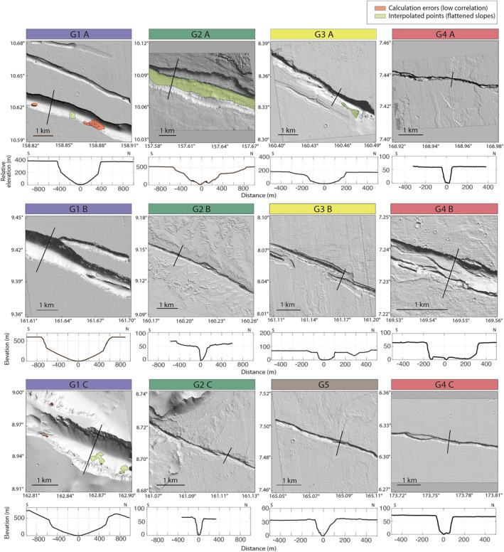
Digital Elevation Models (1 m/pixel) built from High‐Resolution Imaging Science Experiment stereo pairs along the five main fossae (G1, G2, G3, G4, and G5) of Cerberus Fossae (see locations on Figure 1). One across strike relative topographic profile is shown below each DEM (see Figure S2 in Supporting Information S1 for all and mean profiles).