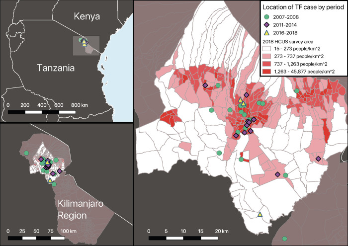
Fig 2. Geo-spatial location of typhoid fever cases, Kilimanjaro Region, Tanzania, 2007–2018.
Map A shows Kilimanjaro Region in northern Tanzania; the region shown in map B is highlighted by the grey rectangle. Map B shows Kilimanjaro Region and, superimposed onto it, the 2018 HCUS catchment area, which included Moshi Urban, Moshi Rural and Hai districts. Map C includes village locations for typhoid cases by study period. Population density quartiles are layered on the HCUS map to allow for comparison and show potential clustering of typhoid cases in urban areas as well as cases that resided in less densely populated areas. Abbreviations: TF, typhoid fever.

