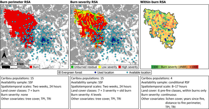
FIGURE 2.

Example of spatial distribution of used and available caribou locations, and different burn characteristics for three separate resource selection analyses of female caribou (Rangifer tarandus) in eastern Alaska and western Canada. Panels show a 1998 fire in the Kluane caribou range, Yukon (YT), and GPS locations from one caribou during February 2014. Evergreen forest is the reference land cover category for the left and centre panels, and pre‐fire evergreen forest is the reference land cover category for the right panel. All other land cover categories are not shown. For simplicity, the fourth burn severity category (“regrowth”) is not shown in the middle panel
