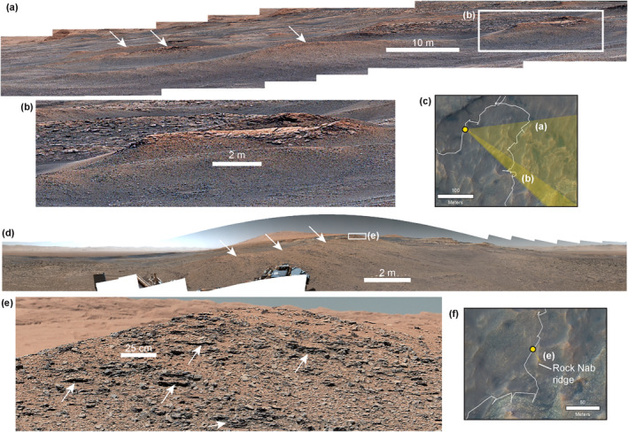
Figure 12.

(a) Left‐eye Mastcam mosaic looking to the ESE of Gillies Hill ridge acquired on sol 2320. White arrows point to other ridges in the background. (b) Capping Knockfarril Hill member sandstone on the Gillies Hill ridge in a left‐eye Mastcam mosaic acquired on sol 2320. (c) High Resolution Imaging Science Experiment image showing the approximate viewshed of panels (a and b). The center coordinate (lat, lon) of the area shown is −4.7296, 137.3836. (d) Left‐eye 360° Mastcam mosaic of the Rock Nab ridge in the Knockfarril Hill member acquired on sol 2560. White arrows point along the crest of the ridge; the white box shows the location of the outcrop shown in panel (e). (e) Close‐up view of the bedrock comprising the Rock Nab ridge in a right‐eye Mastcam mosaic acquired on sol 2564. (f) HiRISE image showing the approximate viewshed of panel (e). The 360° mosaic in panel (d) was also taken from this position. The center coordinate (lat, lon) of the area shown is −4.7315, 137.8535. Image credit for Mastcam images: NASA/Caltech‐JPL/MSSS.
