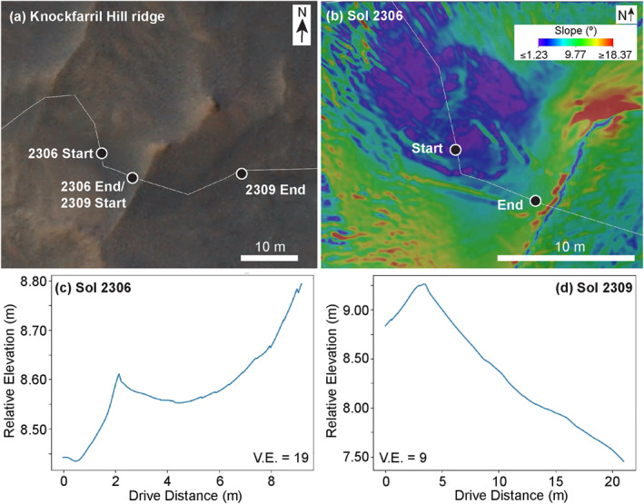
Figure 16.

Mobility data from the Sol 2306 and 2309 drives up and down the namesake Knockfarril Hill ridge. (a) High Resolution Imaging Science Experiment (HiRISE) map showing the start and end of the sol 2306 and 2309 drives. The center coordinate (lat, lon) of the area shown is −4.7292, 137.3803. Illumination is from the left. HiRISE image ID: ESP_039280_1755. (b) Slope map derived from sol 2306 Navcam stereo data. North is up for panels (a and b). (c) Elevation profile for the sol 2306 drive extracted from the Navcam stereo data. Vertical exaggeration is 19. (d) Elevation profile for the sol 2309 drive extracted from the Navcam stereo data. Vertical exaggeration is 9.
