
FIGURE 2.
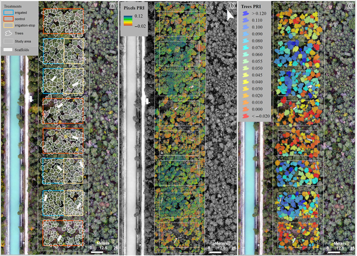
Remotely sensed photochemical reflectance index (PRI) from drone‐based multispectral imagery acquired on 12 August 2020 over a Pinus sylvestris forest at the long‐term precipitation manipulation (irrigation) experiment in Pfynwald (Canton Valais), Switzerland. The experimental plot design distinguishing three treatments (control, irrigation‐stop, irrigated) is shown on the left (a), including tree crown polygons and scaffold positions. Pixel‐level and tree‐level PRI maps are shown in the centre (b) and on the right (c), respectively [Colour figure can be viewed at wileyonlinelibrary.com]