
FIGURE 1.
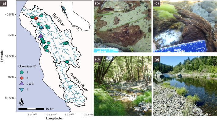
Sampling locations and field photos of sampling sites. (a) Map of Eel and Russian River watersheds showing which Microcoleus species were recovered from the different sampling sites. (b) Thin (<2 mm) Microcoleus collected from shaded cool‐water creek. (c) Thick (>10 mm) Microcoleus mat over‐growing filamentous Cladophora glomerata in the sunny warm main‐stem. (d) Rattlesnake Creek sampling site (PH2017_40) with riparian vegetation shading the wetted channel (subwatershed drainage area, 50 km2). (e) South Fork Eel sampling site (PH2017_09) with no riparian canopy cover (subwatershed drainage area, 1,392 km2)