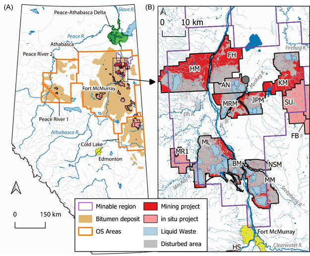
Figure 1.

Map of oil sands regions in Alberta, Canada, (A) and minable region (B) showing the bitumen deposit area, oil sands administrative areas (e.g., Athabasca oil sands region), the minable region, boundaries of operating mining and in situ projects (2016), locations of wastewater ponds, and disturbed areas; AN, Syncrude Aurora North; BM, Suncor Basemine; FB, Suncor Firebag; FH, Fort Hills Mine; HM, Horizon Mine; HS, Athabasca Hangingstone; JPM, Jackpine Mine; KM, Kearl Mine; ML, Syncrude Mildred Lake; MM, Suncor Millennium Mine; MR1, Suncor MacKay River; MRM, Muskeg River Mine; NSM, Suncor North Steepbank Mine (also known as Steepbank Mine); and SU, Husky Sunrise. Further landscape and industry details are available in Figure S1 and Table S1; the centroid of the minable region is also shown (grey circle in B)
