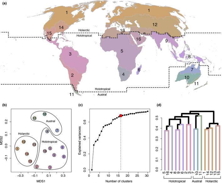
Fig. 1.

Map of the terrestrial phylogenetically distinct phytogeographic regions of the world (a), and their relationship presented as a nonmetric multidimensional scaling (NMDS) ordination plot (b) and as a unweighted pair‐group method using arithmetic averages (UPGMA) dendrogram (d) of beta diversity (pβsim) estimated across 200 km × 200 km grid cells. Sixteen units were defined based on the ‘elbow’ method, considering the range of explained variance (c). Colours differentiating between units in the NMDS plot, dendrogram and map are identical. Dashed lines highlight the borders of the three kingdoms: Holarctic, Holotropical, and Austral, corresponding to the three major clusters in (d). NMDS stress = 0.156.
