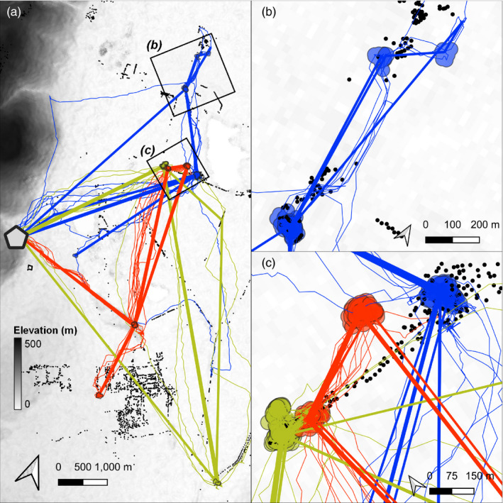
FIGURE 8.

Synthesising animal tracks into residence patches can reveal movement in relation to landscape features, prior exploration and other individuals. (a) Linear approximations of the paths (coloured straight lines) between residence patches (circles) of three Egyptian fruit bats Rousettus aegyptiacus, tracked over three nights in the Hula Valley, Israel. Real bat tracks are shown as thin lines below the linear approximations, and colours show bat identity. The grey hexagon represents the roost‐cave at Gar Hershom. Black points represent known fruit trees. Background is shaded by elevation at 30‐m resolution. (b) Spatial representations of an individual bat's residence patches (green polygons) can be used to study site‐fidelity by examining overlaps between patches, or to study resource selection by inspecting overlaps with known resources such as fruit trees (black circles). In addition, the linear approximation of movement between patches (straight green lines) can be contrasted with the estimated real path between patches (irregular green lines), for instance, to determine the efficiency of movement between residence patches. (c) Fine‐scale tracks (thin coloured lines), large‐scale movement (thick lines), residence patch polygons and fruit tree locations show how high‐throughput data can be used to study movement across scales. Patches and lines are coloured by bat identity
