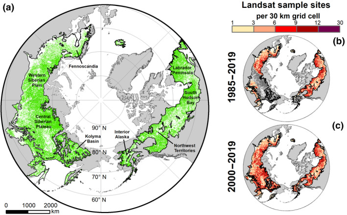
FIGURE 1.

Spatial extent of boreal forest study domain and locations of Landsat sample sites. (a) Boreal forest stretches across northern Eurasia and North America to form one of Earth's largest terrestrial biomes (15.1 million km2). The boreal study domain (green) included natural vegetation with low human pressure and no detectable disturbance since the early 1980s (8.4 million km2). Lands in the boreal forest that were masked from analysis are shown in white. (b,c) Locations of Landsat sample sites that were used for assessing changes in vegetation greenness from (b) 1985 to 2019 and (c) 2000 to 2019, shown here as the number of sample sites in a 30 x 30 km grid cell. Lands in the boreal forest without adequate data for time series analysis are shown in dark gray. The spatial extent of the boreal forest biome is from the World Wildlife Foundation's Terrestrial Ecoregions of the World dataset (Olson et al., 2001). Map Projection: North Pole Lambert Azimuthal Equal Area
