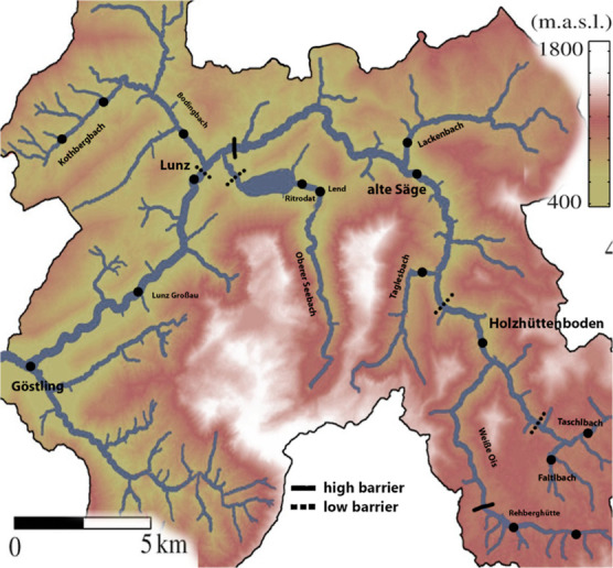
Figure 1.

Map of the river Ybbs catchment (47° 84′ 50″ N, 15° 81′ 20″ E) with fish sampling sites. Thick lines indicate impassable (high) migration barriers. Dashed lines indicate low impact migration barriers such as fish ladders or weirs that might be seasonally passable.
