
Figure 1.
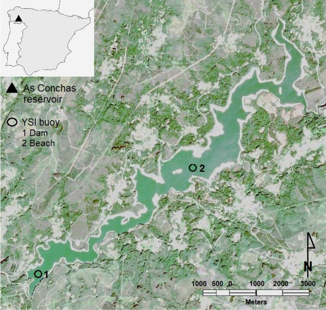
Buoys location in As Conchas reservoir. (1) Dam buoy (4156’41.78”N; 81’47.96”W) and (2) beach buoy (4157’56.57”N; 759’15.27”W). The image was taken by sentinel 2 on September 25, 2018, a cloudless day. The daily mean Chl-a collected by the beach buoy on that day was 24.70 g/L, while at the dam buoy it was 41.98 g/L. The satellite image was obtained from the ESA (European Space Agency) Sentinel database using the Application Platform (SNAP) that is an open access software developed by Brockmann Consult, SkyWatch and C-S under the Creative Commons CC BY-SA 3.0 IGO license (https://step.esa.int/main/download/snap-download/, https://www.esa.int/ESA_Multimedia/Copyright_Notice_Images). The image was generated in RGB, channels B4, B3 and B2 (pixel resolution 10m). Water colors were highlighted using the histogram (RGB) and normalized. Finally, the study area was cropped and this figure was composed.