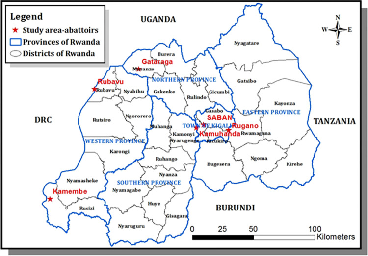
Fig 1. Map of Rwanda with provinces and districts and red stars show the locations of abattoirs visited in this study.
This map was produced in the ArcGis Desketop 10.1–10.8.2 of the University of Rwanda with concurrent use and Education licence. Spatial data (shapefiles) are freely available from DIVA-GIS. (https://gadm.org/download_country.html and https://diva-gis.org/gdata).

