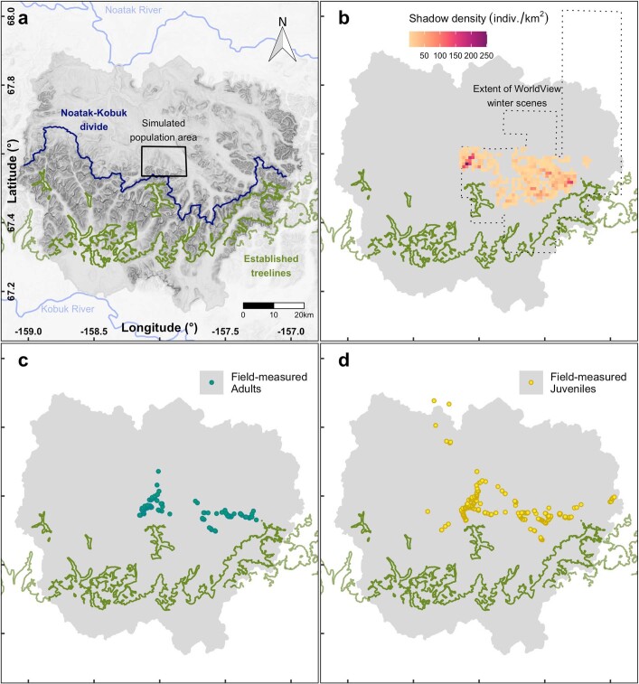
Extended Data Fig. 1. Adult and juvenile white spruce have colonized above and beyond established-treelines.
a Baird Mountains of the Brooks Range separate Arctic Noatak basin from boreal Kobuk basin. Noatak-Kobuk hydrologic divide shown as dark blue line. Established-treelines visible on World View (WV) summertime imagery shown as olive green line from reference 44. Noatak and Kobuk Rivers in light blue. Gray polygon boundary encloses four Noatak and four Kobuk watersheds of area of interest (AOI). Small, central rectangle encloses population simulated over time in Fig. 3a with adult spruce densities shown for western portion in Extended Data Fig. 2a. b Density of spruce tree shadows as individuals per square-kilometer rasterized from shadows digitized on WV1 and WV2 snow covered scenes (Fig. 1b, SI Figs. 1, 4–13). Dotted outline shows extent of imagery used to digitize shadows of trees over approximately 2.5 m tall. c Adult white spruce (≥2.5 m or cone-bearing) measured for height and other ecological measures (including 140 increment cored for dendrochronology) geolocated in the field using GNSS. d Juvenile (<2.5 m) spruce geolocated in the field using GNSS. Two juveniles were found north of the Noatak River and near to but outside the AOI. They are included in the analysis.

