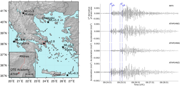
Figure 2.
MFFI comparison to ATHP accelerometer. (Left) A map of Greece showing in a red box the location of MFFI system and ATHP accelerometric station (the inset magnifies the area contained in the rectangular frame) and the epicenters with black stars of earthquakes selected for analysis in the present study. (Right) Comparison of the time series collected by MFFI and ATHP regarding the earthquake taking place east of Crete Island (October 12, 2021, 09:24:03 UTC, Crete (ML = 6.3)). Pg/Sg, Pn/Sn theoretical arrival times are marked with blue dotted lines for reference. Map on the left has been created using open software GMT ver 5.4 (https://www.generic-mapping-tools.org/).

