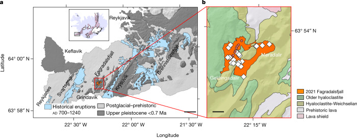
Fig. 1. Geological setting.
a, Geological setting of the RP and the ITSCs of Reykjanes, Svartsengi, Fagradalsfjall, Krýsuvík and Brennisteinsfjöll extending from west to east are shown in bold13. The inset map of Iceland shows the location of the RP. Scale bar, 5 km b, The Fagradalsfjall ITSC and the eruption sites. The extent of the lava field corresponds to 10 May 202116. The eruptive vents are shown with red circles. Sampling localities are also shown with white diamonds. Scale bar, 1 km.

