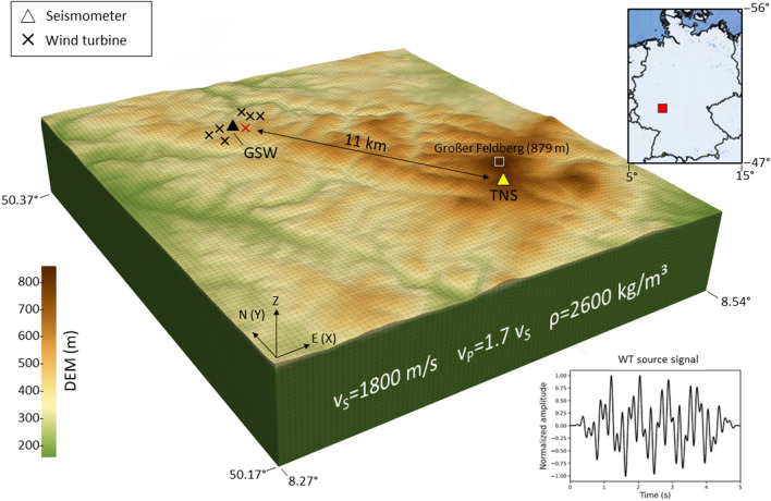
Figure 1.
Model setup with a digital elevation model (DEM) of the local topography. The source time function of the WT used for modelling (bottom right) is obtained by summing three sinusoidal curves with frequencies of 1.15 Hz, 3.5 Hz and 6.0 Hz, each with a duration of 5 s. The temporary seismic station (GSW) is located within the Weilrod WF. The permanent seismic station (TNS) is located approximately 11 km from the WF atop the Kleiner Feldberg (about 1.3 km to the southwest of Grosser Feldberg). The coordinates of the model are given in WGS84. The thin grey lines indicate the computational mesh elements. The position of the WT used for simulations with one source only is marked by red cross. The computational model covers an area of 17 km × 19 km and a depth of 3.2 km.

