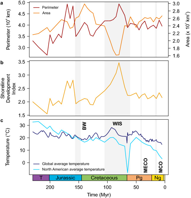
Figure 3.

Abiotic factors used in this study. (a) Continental area and perimeter, (b) the resulting Shoreline Development Index (SDI), as well as (c) regional and global average temperature through geological time. Time intervals with major seas/wetlands and climatic events referred to in the text are marked by gray bars. Note that the last time bin (0–5 Myr ago) was omitted; see Methods for details. BW, Bighorn wetlands; MECO, Middle Eocene Climate Optimum; MCO, Miocene Climate Optimum; WIS, Western Interior Seaway.
