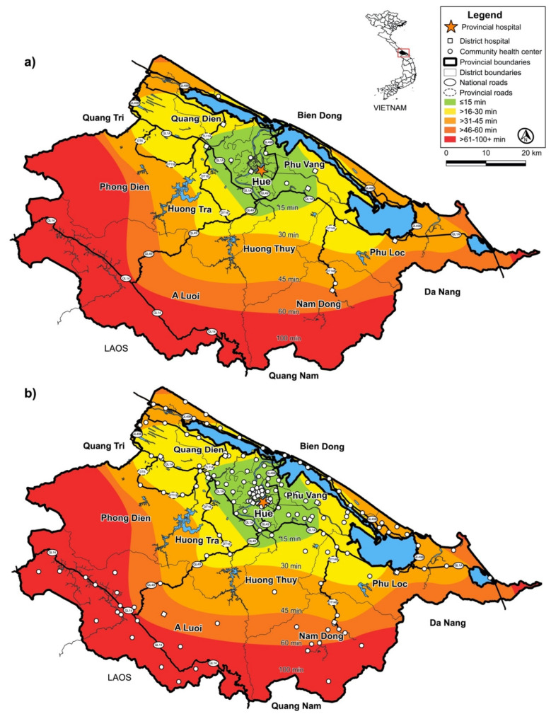
Figure 3.
(a) SWN time contours of surveyed health facilities. Thua Thien Hue Province SWN time contours (top) illustrate the temporal and geospatial domains for the community health centers and district hospitals to reach Hue University Hospital. Physical road maps are shown by highways illustrating the most efficient routes patients take by traveling from one site to a referral site downstream of the SCP. Travel times (colored contours) and main roads (bold black) are shown. Surveyed community health centers in the red zone should perform rapid POCT on-site to allow patient transport directly downstream and bypass the district hospital while reducing TTAT for rapid treatment and isolation. All community health centers surveyed lacked microbiology facilities. Thus, POC pathogen detection would be useful in all zones. (b) District hospitals and community health centers in Thua Thien Hue Province. The time contours map (bottom) illustrates the temporal and geospatial domains between all community health centers and all district hospitals to reach Hue University Hospital. Influx of travelers from Laos, Quang Nam, Da Nang, and Quang Tri requires several hours, as they will be required to travel in a stepwise fashion through each level before reaching interventional care. Community preparedness can be enhanced with POCT in community health centers in the red zone that lack adequate diagnostic testing. POCT available near patients in community health centers and district hospitals could serve as a hub for incoming travelers and locals who require rapid medical response.

