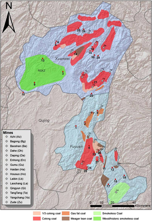
Fig. 1.
Map of Xuanwei and Fuyuan counties showing approximate locations of study villages, reported coal mines and coal sub-types. Villages enrolled in the study are marked numerically 1 to 30. The mine locations indicated represent functioning mine entrances, therefore, some mines may be indicated more than once. Only mines reported by study participants are indicated.

