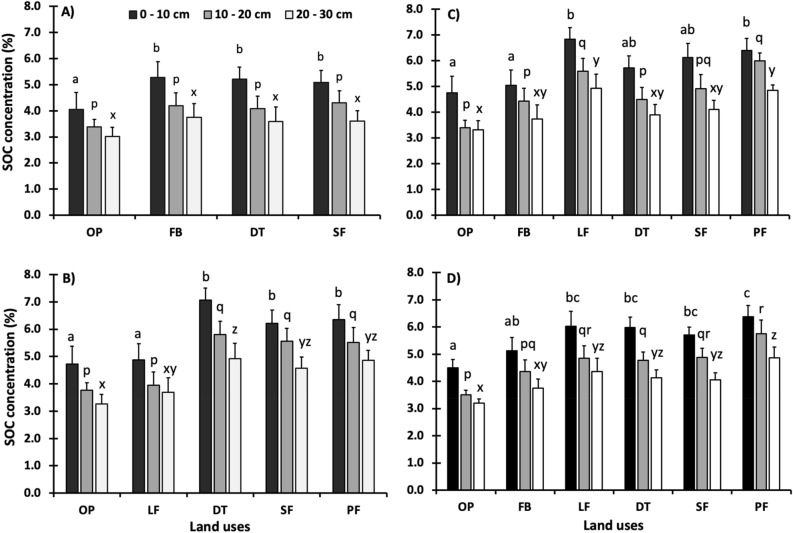
Figure 3.
Soil organic carbon (SOC) content (%) across sampled land uses by soil depth category. (A) Jalisco, (B) Campeche, (C) Chiapas, (D) All regions. Lowercase letters above the bars indicate significant differences between land-uses in the same soil depth category. The y-axis shows SOC content (%) and the x-axis shows the different land-uses sampled, where OP = Open pasturelands, FB = Fodder banks, DT = Pasturelands with dispersed trees, LF = Live fences, SF = Secondary forests, PF = Primary forests.

