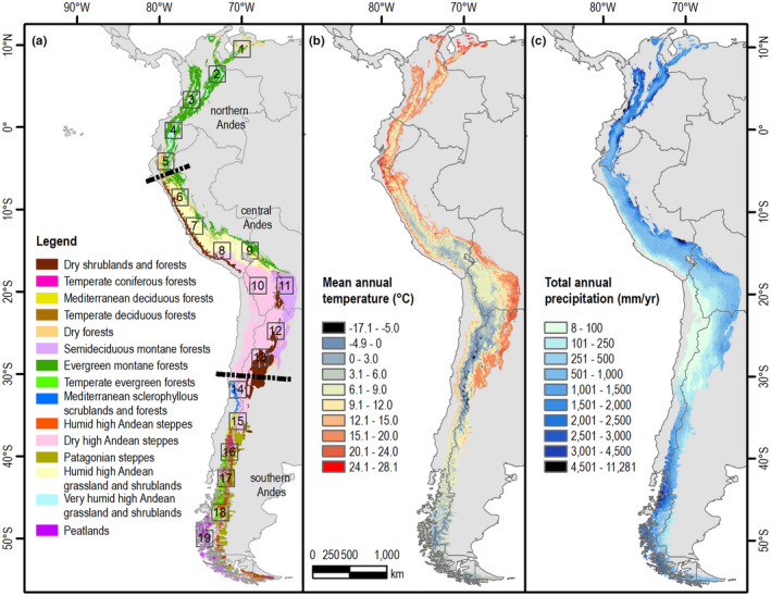
FIGURE 1.

The Andes. (a) Andean biomes based on three vegetation maps (Luebert & Pliscoff, 2018; Oyarzabal et al., 2018; Tovar et al., 2013), major three regions (Northern, Central and Southern Andes) and 19 locations (2° × 2° bounding boxes, indicated by the numbers along the Andes) where climate change projections were analysed for this review, (b) mean annual temperature and (c) total annual precipitation obtained from CHELSA for the period 1979–2013 (Karger et al., 2017). Maps in geographical coordinate system
