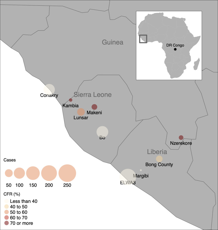
Fig 1. Map of children with Ebola Virus Disease (EVD).
The map shows the geographical distribution of children with EVD included in triage data from the Ebola Data Platform, collected during the West African EVD outbreak from 2014–2016. Bubble size corresponds to the number of cases reported, and color corresponds to observed case fatality rate. Plotted with the R package tmap [52], using base layer maps in the public domain from the Natural Earth project (https://www.naturalearthdata.com/about/terms-of-use/).

