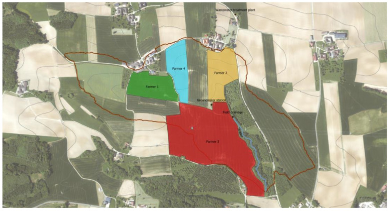
Figure 4.
Aerial view of the HOAL in Petzenkirchen, Lower Austria. The limit of the HOAL is depicted by the red line. The sampled fields are colored by farmer. Green, yellow and red fields are sown with corn. The field in blue is sown with wheat. The blue line represents a stream (i.e., compartment “river”). Alongside there is a field drainage and groundwater station. The wastewater treatment plant is outside the catchment area, next to the house of farmer 2.

