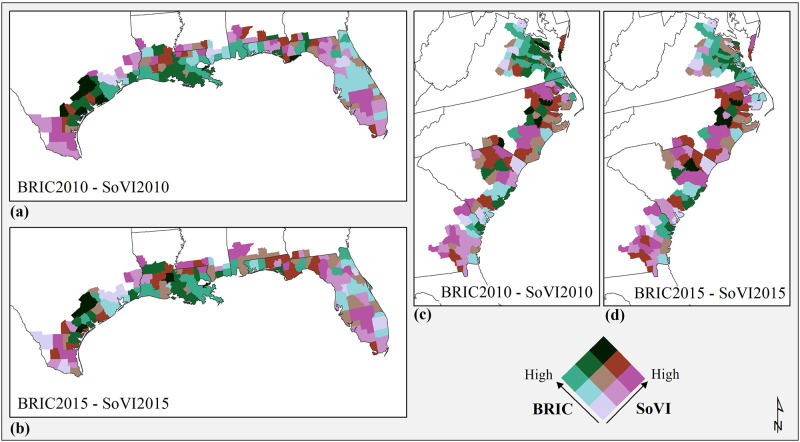
Fig 4. Bivariate maps for BRIC and SoVI Gulf region counties (a) 2010, (b) 2015, and southeast Atlantic coastal counties (c) 2010, (d) 2015.
County and state boundaries are retrieved from the U.S. Census Bureau (https://www.census.gov/geographies/mapping-files/time-series/geo/carto-boundary-file.html).

