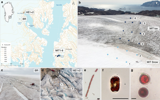
Figure 1.
Algal community sampling locations in SE-Greenland: (a) Black square on the Greenland map insert marks the sampling region; sampling locations are shown by dots on the topographic map (Mittivakkat = MIT, Bruckner = BR, Heim = HE) and ice coverage is indicated by the bright blue area on land. The map was created using QGIS v.3.16 (http://www.qgis.org)78. (b–d) Drone photos of sampling locations on Mittivakkat, Bruckner and Heim Glaciers. On Mittivakkat, sampling was done along a transect of 1.14 km length along a snow-to-ice gradient with decreasing altitude. Snow and bare ice sampling sites are grouped for habitat and glacier comparisons as “MIT Snow” and “MIT Ice”. (e–g) The three dominant algal species across glaciers: glacier ice algae (A. nordenskiöldii, A. alaskanum) and snow algae (Chlamydomonadales sp.) with scale bars of 20 µm.

