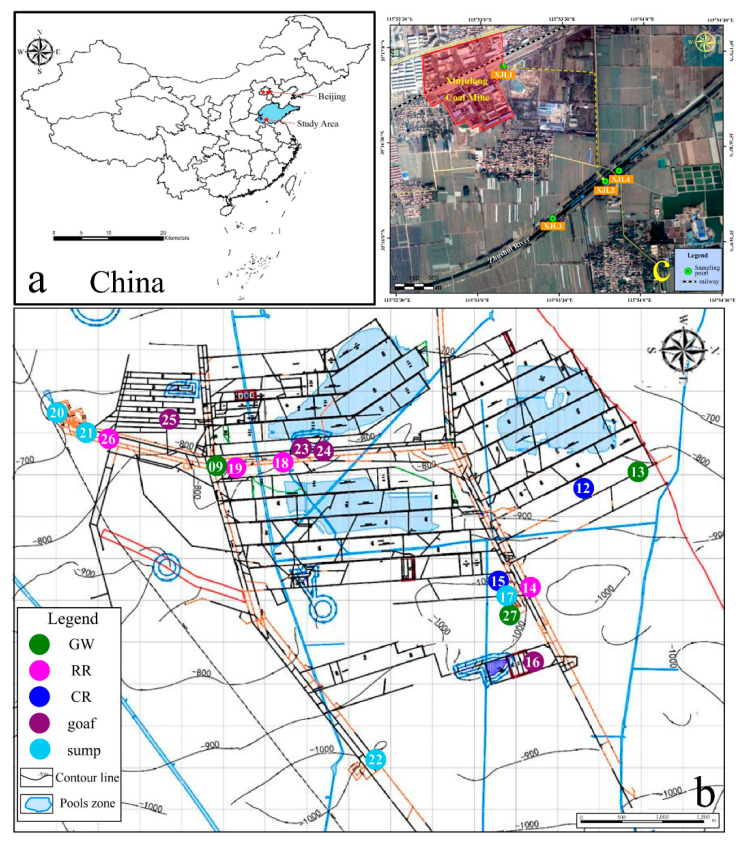
Figure 1.
Locations of sampling sites in Xinjulong coal mine and mine-water-discharged Zhushui River in Shandong Province, China. Xinjulong coal mine is located in Shandong Province, China (a). Sampling sites included 17 underground sites (b) and 4 surface water sites (c). Note: The number in image b (XJL is omitted) represents the sample point name, and detailed sampling place is shown in Table S1. GW, RR, CR, goaf, sump, and SW refer to groundwater aquifers (XJL9, XJL13, XJL27), rock roadways (XJL14, XJL18, XJL19, XJL26), coal roadways (XJL12, XJL15), goafs (XJL16, XJL23, XJL24, XJL25), water sumps (XJL17, XJL20, XJL21, XJL22), and surface waters (XJL1, XJL2, XJL3, XJL4), respectively. The blue and yellow arrows refer to the flow direction of the river and the mine drainage, respectively.

