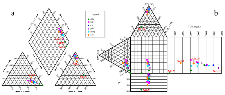
Figure 3.
Piper (a) and durov (b) diagrams of the water samples. The points with same colors and shapes represent water samples from the same zones. Note: GW, RR, CR, goaf, sump, and SW refer to groundwater aquifers, rock roadways, coal roadways, goafs, water sumps, and surface waters, respectively.

