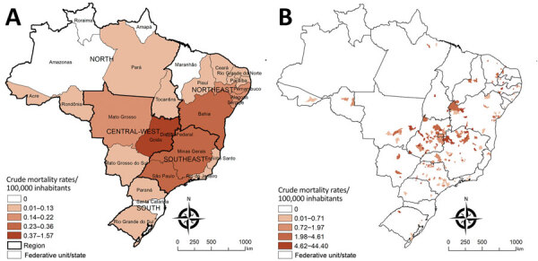
Figure 2.

Spatial distribution of cumulative mortality rates per 100,000 inhabitants related to Chagas disease and COVID-19 co-infection by geographic units of residence, Brazil, March–December 2020. A) State-level crude rates. B) Municipality-level crude rates. Shading indicates levels of death. Data were mapped by using ArcGIS software version 9.3 (Esri, https://www.esri.com). In 2020, Brazil was divided into 5 regions (South, Southeast, Central-West, North, and Northeast), 27 Federative Units (26 states and 1 Federal District), and 5,570 municipalities.
