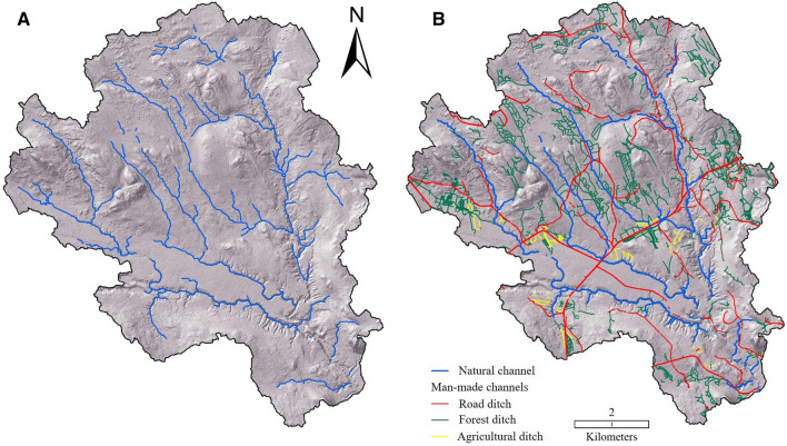
Fig. 7.
(A) The prehistoric natural channel network of the Krycklan Catchment (region #4). The network is modeled using a 6.3 ha channel initiation threshold, based on the digitized natural channel heads (Fig. 5). (B) The current channel network of the Krycklan Catchment. The ditch network was manually digitized using a 0.5 m digital elevation model while the natural channels were generated using all digitized channel heads and “trace downstream flow paths” algorithm (Lindsay 2018). For both (A) and (B), the wider channels near the outlet, which are > 6 m wide, as well as lakes and diffuse flow in the peatlands were removed

