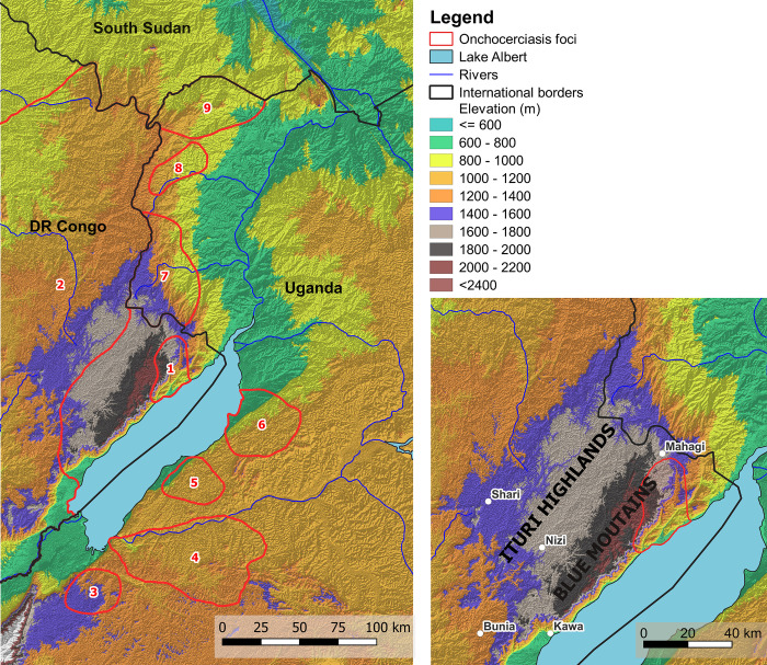
Fig 1. Relief map showing location of the Kakoi-Koda focus and other nearby foci.
1 = Kakoi-Koda focus; 2 = North-Eastern DRC Oncho Endemic Area; 3 = Itwara focus; 4 = Mpamba-Nkusi focus; 5 = Wambabya-Rwamarongo focus; 6 = Budongo focus; 7 = Nyagak-Bondo focus; 8 = Maracha-Terego focus; 9 = West Nile focus. Location of onchocerciasis foci according to Katabarwa et al. [29] and Makenga Bof et al. [8]. (Produced in QGIS: [50]). The RASTER images used to produce Fig 1 are Landsat-7 and Landsat-8 images, courtesy of the U.S. Geological Survey (https://www.usgs.gov/). The basic shapefiles for administrative areas can be found on the Référentiel Géographique Commun for the DRC (www.rgc.cd).

