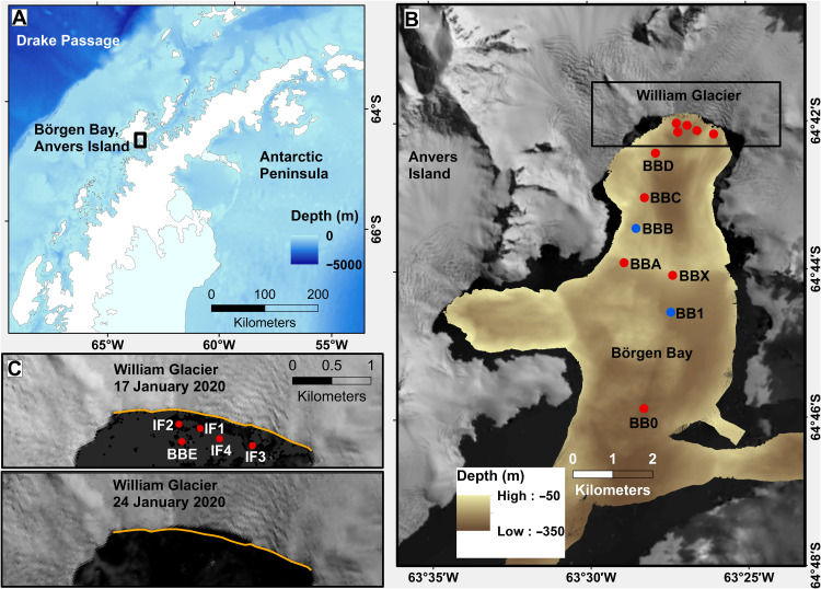
Fig. 1. Field area and glacier retreat due to calving.
(A) Location of Börgen Bay at the West Antarctic Peninsula. Bathymetry from ETOPO 1 global relief model (74). (B) Bathymetry of Börgen Bay from multibeam echosounder data and coastline/topography from Landsat imagery (see Materials and Methods). Dots mark locations of conductivity-temperature-depth (CTD) profiles used here, with profiles taken before (red) and after (blue) the calving event. (C) Landsat images of the William Glacier front from (top) 17 January 2020 and (bottom) 24 January 2020. In both panels, the orange line marks the glacier front on 17 January 2020 to highlight the retreat of the glacier between those dates.

