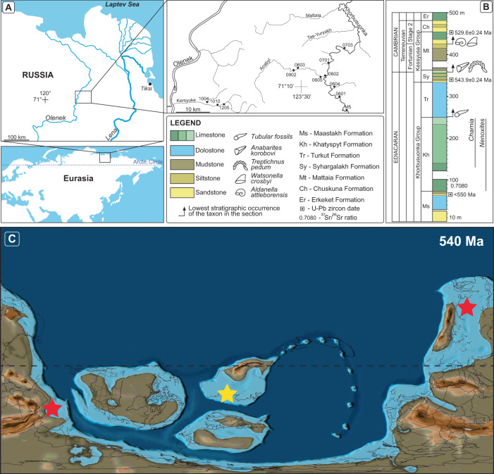
Fig. 1. Geologic and paleogeographic background of the Olenek Uplift.
A Map of the study area and measured sections along the Khorbusuonka and Olenek River areas of northeastern Siberia. B Generalized stratigraphic column of the study units including lithology, fossil content, and radiometric age constraints. 87Sr/86Sr value from ref. 8 and radiometric ages from refs. 30, 33, and this study. Maps in panels A and B were created by the authors using: www.yandex.ru/maps. C Paleogeographic map from 540 Ma with the Olenek Uplift section examined in this study denoted by the yellow star and the coeval Namibia and South China sections denoted by the red stars. Base map from, ref. 102: Scotese, C.R., 2021. An Atlas of Paleographic Maps: The Seas Come In and the Seas Go Out, Annual Reviews of Earth and Planetary Sciences, v. 49, p. 669–718.

