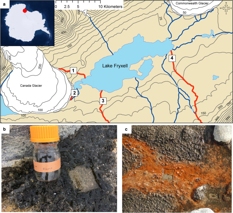
Figure 1.
Locations and types of mat samples used for this study. (a) Map of the Lake Fryxell Basin in Taylor Valley, Antarctica with exact sampling sites (white squares) along streams (red lines: 1. Canada Stream, 2. Bowles Creek, 3. Delta Stream, 4. Von Guerard Stream). Blue lines indicate other streams not included in this study. Types of mats included in this study: (b) black type and (c) orange type with orange type showing regrowth 12 months post sampling. Photo credit: Josh Darling and Mike Gooseff. Map was created with ArcGIS Desktop 10.8.2 (http://www.esri.com).

