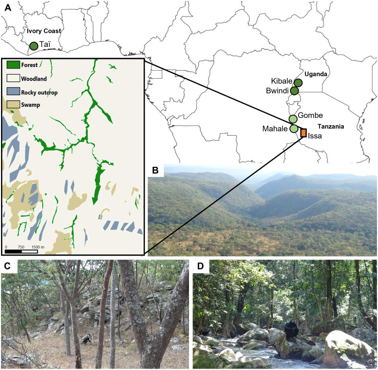
Fig. 1. Issa Valley and other chimpanzee study site locations and habitats.
(A) Issa Valley’s location in western Tanzania relative to Taï (North Group, Ivory Coast), Kibale (Ngogo, Uganda), Bwindi (Uganda), Mahale (M-Group, Tanzania), and Gombe (Kasekela, Tanzania). For comparative purposes, sites are grouped into three categories reflecting the percent forest cover and dryness [following (35)]: dense forest (dark green circles; Taï, Kibale, and Bwindi), forest-mosaic (light green circles; Mahale and Gombe), and savanna (orange rectangle; Issa). Forest sites are considered as closed and savanna as open habitat. The Issa study area is a savanna-mosaic habitat with a long dry season that is dominated by miombo woodland, represented in highlighted habitat map and view of site (B). Issa’s deciduous miombo woodland (C) is classed as open vegetation [grassy understory, broken canopy, low tree density (0.02 trees per square meter), and majority of trees <15 m high], while the evergreen riparian forest (D) is classed as closed vegetation, with vine-dense understory, twice the tree density, taller trees, and a more connected canopy than the woodland (table S4). Bwindi is only included in the intersite comparison of bipedal behaviors as no positional behavior frequency data were collected at this site (38). Photo credit: R.C.D.-C.

