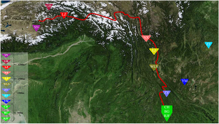
FIGURE 1.

Locations of the sampled populations. Colored signs represent the geographic distribution of the sampling localities of 12 chicken populations including the Shannan (SN) chicken, Gongbujiangda (GB) chicken, Linzhi (LZ) chicken, Nixi (NX) chicken, Lijiang (LJ) chicken, Wuliangshan (WLS) chicken, Yimen (YM) chicken, Zhenyuan (ZY) chicken, Zhaotong (ZT) chicken, Chahua (CH) chickens, Banna game (BG) chicken, and red jungle fowl (RJF) from four altitudes (500, 1500, 2500, and 3200 m+). The red line presents the Ancient Tea Horse Road crossing Yunnan and Tibet.
